Home :: EOI :: SSEC :: LakeSat :: WisconsinView :: About :: Archives
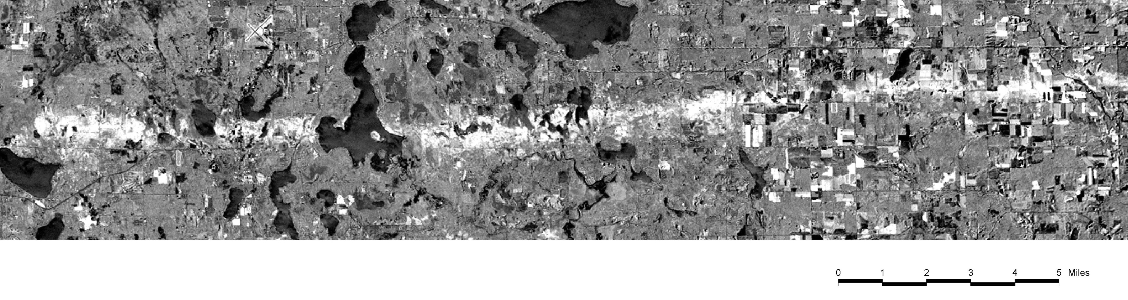
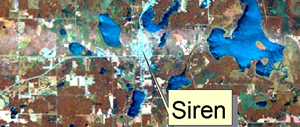
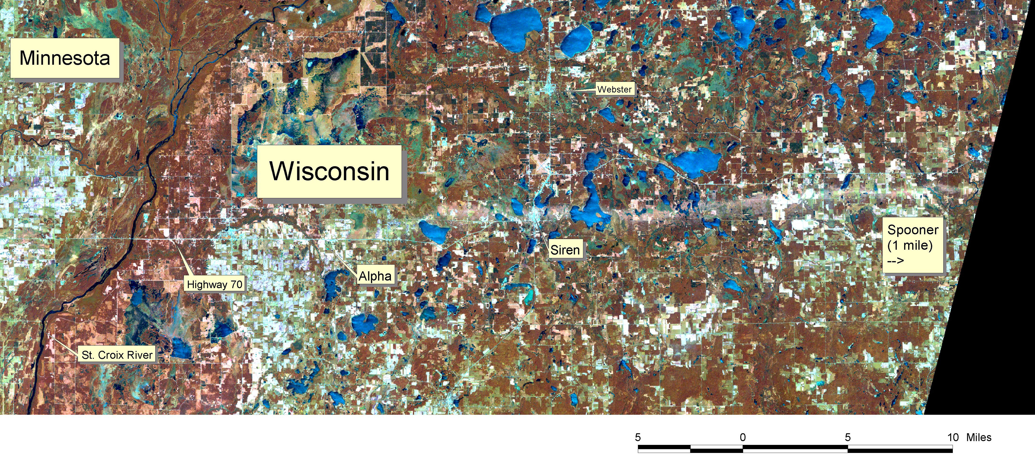
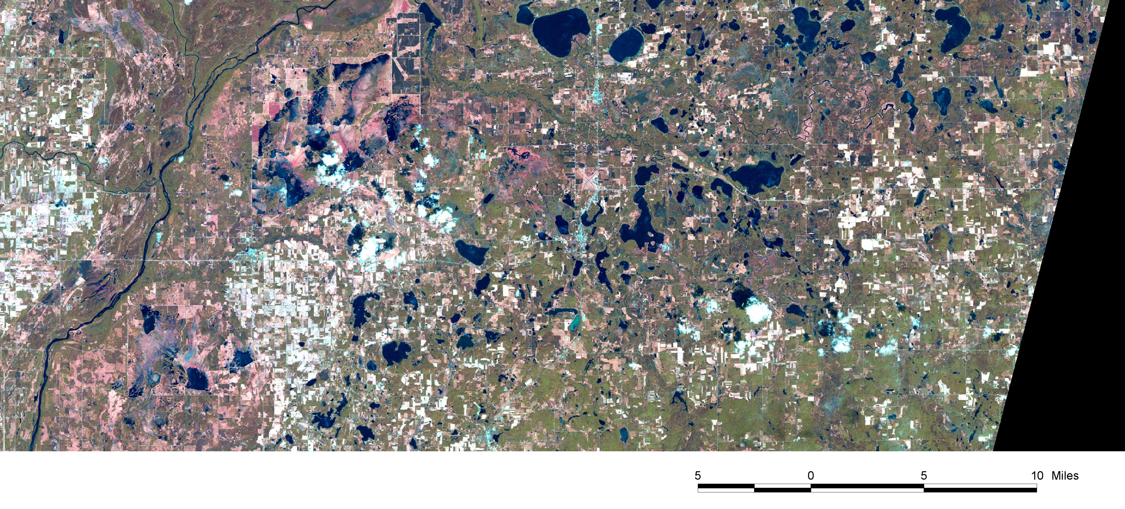
Siren, Wisconsin Tornado June 18, 2001 Destructive Swath
Captured by Landsat 7 Satellite
Captured by Landsat 7 Satellite
 |
||
References & Information |
Download Satellite Images & Georeferenced Data |
|
Siren F3 Tornado Swath Detection
"Timing is everything when trying to document these events via satellite," noted Thomas Lillesand, Director of the Environmental Remote Sensing Center at the University of Wisconsin-Madison. "We were fortunate to have cloud-free images of the area collected both the day after the tornado and essentially one month earlier. We could then register the two images and highlight the damaged areas using digital image processing techniques."
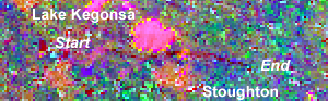
Wisconsin Tornado Outbreak of August 18, 2005
| Change Detection and Mapping
|
|