Home :: EOI :: SSEC :: LakeSat :: WisconsinView :: About :: Archives
Remote Sensing of Tornado Tracks
| ||
| Storm spawning August 18, 2005 Wisconsin tornadoes reaches up over 60,000 feet Photo: ERSC | ||
Images & Information |
Download Mapping Data for the Satellite Images |
|
Wisconsin Tornadoes and Images from Research at ERSC
MODIS Imagery Shows the June 7, 2007 Northeast Wisconsin Long-Track Tornado (White Lake) Swath 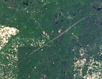 (click for GoogleMaps interface) Clear skies on June 9th 2007 made it possible to see the destruction swath in imagery collected by the MODIS sensor on both the Terra (12:28pm) and Aqua (2:09pm) satellite overpasses.
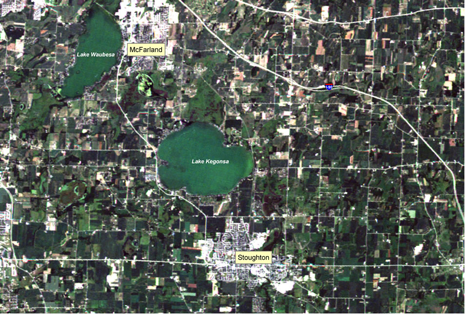
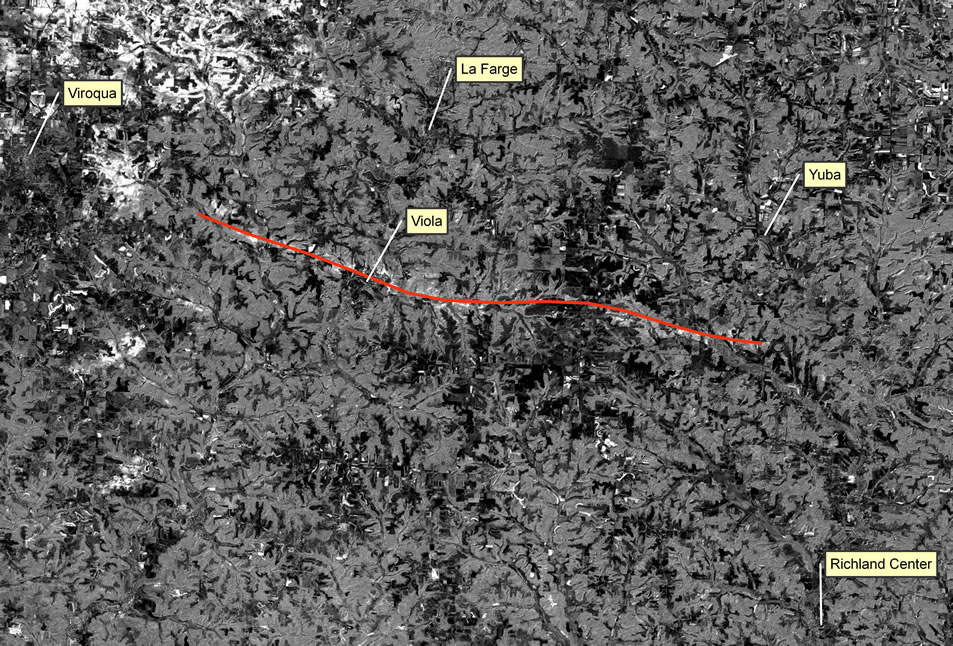
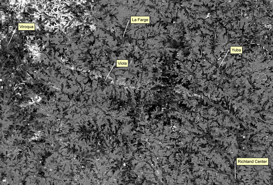
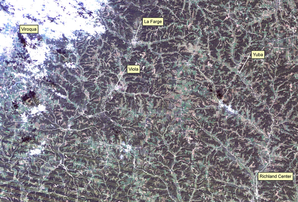
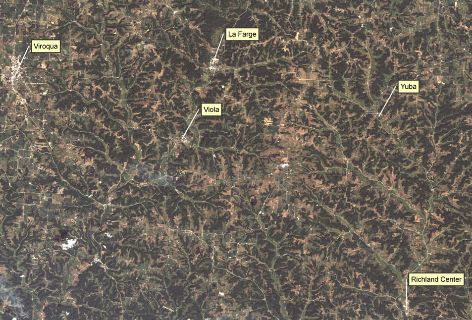
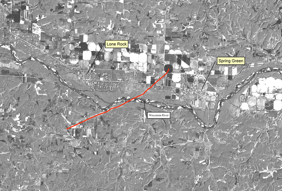
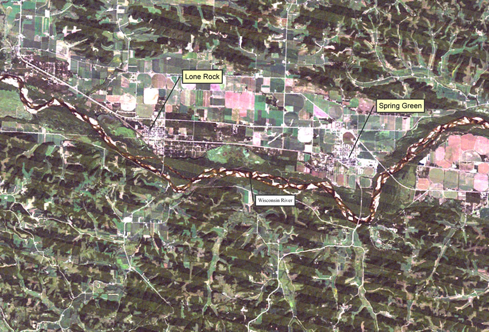
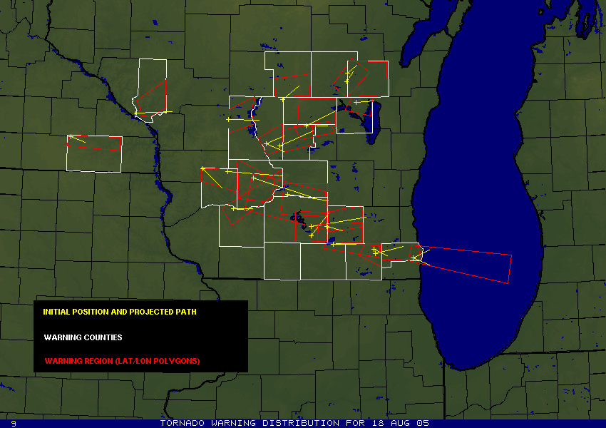
 The following August 18, 2005 Satellite images acquired by Landsat and ASTER instruments show large tornadoes and can be viewed with any internet browser.
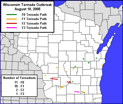
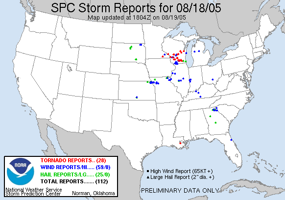
WI Outbreak of August 18, 2005
News of the destruction wrought by a one-day record 28 tornadoes was reported around the world - more than 300 stories according to Google. Many of the those linked below include dramatic photos and video.
ERSC began researching the potential for detecting and mapping tornado tracks from space in 2001. This research included processing and delivering images to county and emergency management personnel who were responding to the 2001 Siren, WI Tornado.
For more background, see the Siren Tornado Case Study or the research paper:
| Emergency Management & GIS Professionals
GeoTIFF of the MODIS image and a shapefile of the Northeast Wisconsin Long-Track swath are available in WTM projection through WisconsinView 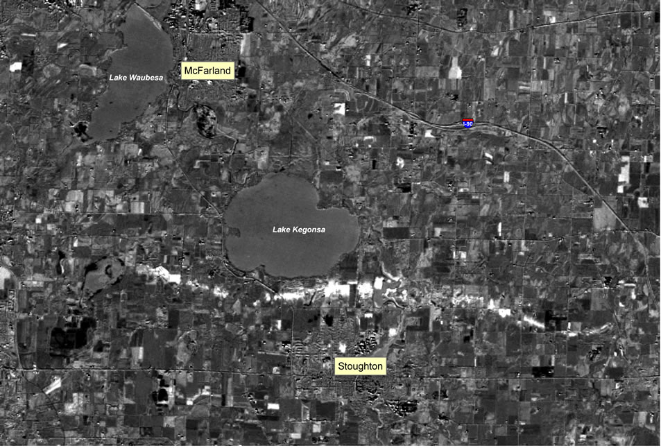
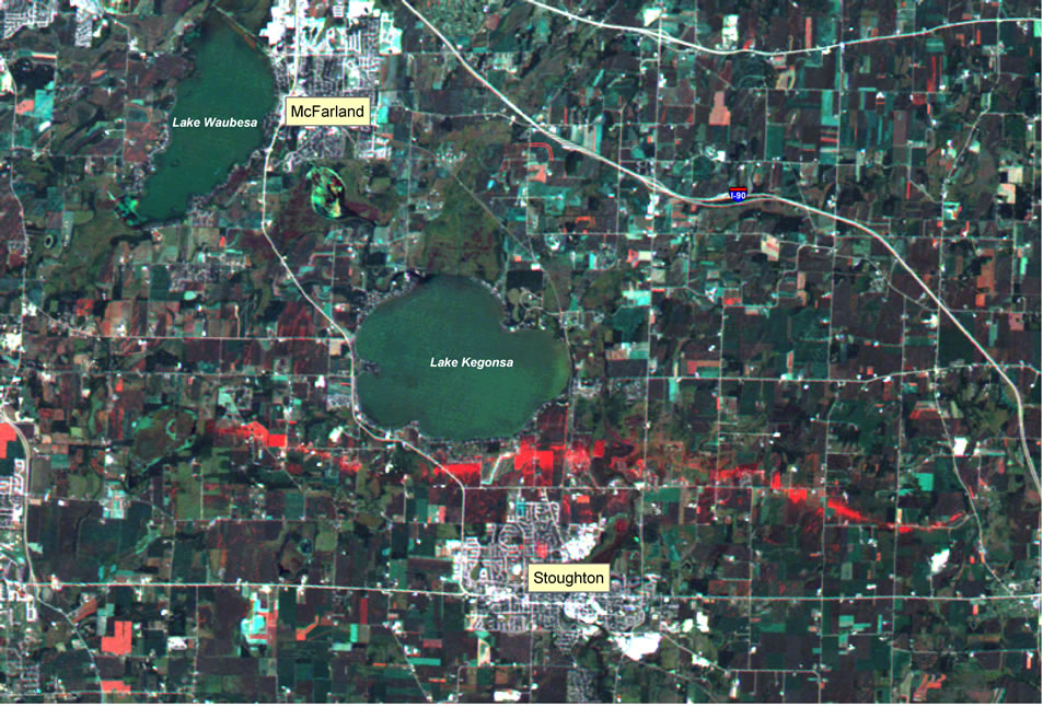
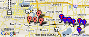
Use our WisconsinView Data Portal to map the Stoughton, Spring Green, Viola & Siren Tornadoes 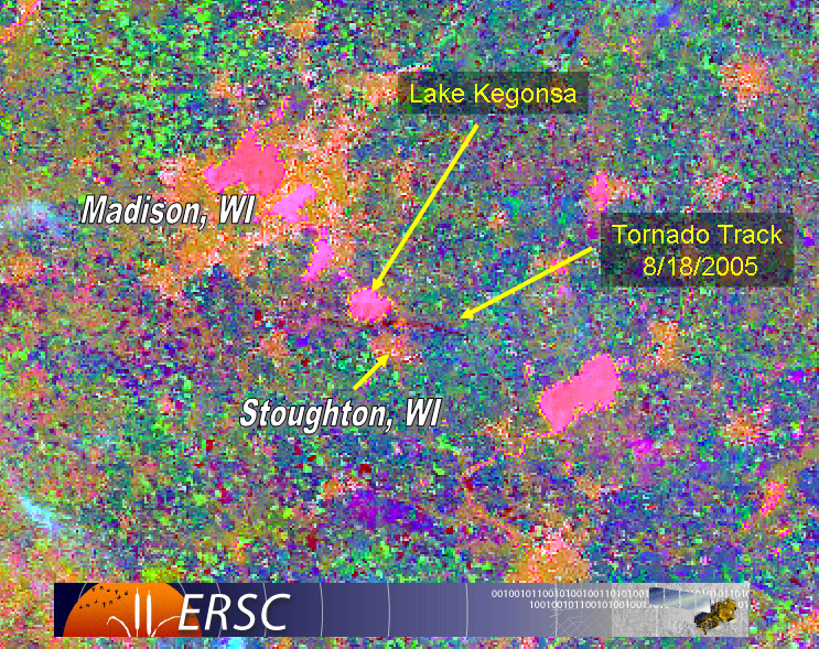
Using GIS to map the tornado tracks requires specialized software. |
|